What we do

The floodplain of the Amazon River — where flora, fauna, and human communities have adapted to an annual 7 m flood wave — supports a wealth of biodiversity and extremely productive fisheries. Recent research has demonstrated that these resources are under threat from climate change (Fabré et al. 2017; Barichivich et al. 2018) and deforestation driven by cattle ranching and agriculture (Renó et al. 2016).

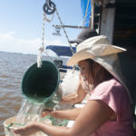
Our project « Sustaining Amazon floodplain Biodiversity and fishERiES under climate change » (SABERES) combines remote sensing, hydrologic modeling, fisheries and habitat modeling, and participatory work with local riverine communities to develop policies and strategies to conserve Amazonian biodiversity and fisheries in the face of climate change. We focus on the lower Amazon floodplain in the state of Pará, Brazil, where riverine communities and governmental agencies are currently developing improved fisheries legislation. The productivity of these fisheries depends on the integrity of, and biodiversity associated with, floodplain forests, savannas, and lakes. Preserving biodiversity and fisheries under climate change can only be accomplished in a common framework, with strategies developed in partnership with local communities.

This project addresses several aspects of the impacts of climate change on biodiversity. We will predict the effects of climate-driven changes in inundation regimes on fish, forests, and phytoplankton, and will assess fisheries co-management, floodplain reforestation, and other strategies for mitigation/adaptation to climate change.  We will explore a range of future scenarios using agent-based modeling, and predict effects of climate change on ecosystem services including fisheries productivity and water quality.

Our interdisciplinary research program incorporates innovative remote sensing products and methods, and physically-based models for hydrology, fish ecology, social and political sciences. It is organized into six interlinked scientific work packages: 

Our WP1 tasks address major limitations of the current generation of floodplain vegetation/inundation maps and methods, including: 1) production of static maps, time-consuming to produce, not easily updated, and without integration of vegetation and water properties information; 2) lack of information on the vertical structure of vegetation; and 3) lack of information on phytoplankton and water properties of small lakes and channels. T1.1

To learn more

We will produce hydrologic projections under current conditions and future climate scenarios and related flood extent, water depth, hydroperiod maps, required for WP3-5 activities.

To learn more

The Amazon floodplain hosts a wealth of biodiversity, including fish populations that provide a primary source of animal protein, livelihoods, and income for millions of people in the study area (Isaac & Almeida 2011). Seasonally flooded forests, shrubs, and grasslands occur along a gradient of flooding depths. Fish move into these environments to benefit from abundant food and nursery habitats, increasing their biomass and the productivity of fishing activities.

To learn more

We will engage local stakeholders (fishers, farmers) in developing fisheries and land use strategies to cope with climate change while preserving wetland and adjacent upland biodiversity and fundamental ecosystem services under the different hydroclimatic scenarios produced in WP2. Following a Companion Modelling approach (Etienne, 2013), we will use agent-based models (ABMs) that represent social agents, their different strategies regarding fisheries or land use choices, their interactions, and the ecological dynamics linked with their practices. Simulations will integrate social and ecological dynamic factors and analyze some possible trajectories of the socio-ecological system. Working in communities of Lake Curuai, Biommel et al. (2016) previously developed a model of farmer practices and impacts on land cover, using a representative transect of four communities from floodplain to upland. Our partner BONDS project will allow us to gather additional information on fishing practices and to implement the model at the floodplain scale. Focusing only on the Curuai site, our SABERES team will gather additional knowledge on local actors’ practices, improve the representations of fish yields and biodiversity dynamics using WP3 results, and explore future scenarios produced in WP1 under co-management policies proposed in WP5. T4.1 will consolidate the ABM from information of a larger set of communities. T4.2 will explore co-management policies comparing several scenarios in terms of management (current, no regulation, co-management from WP5) under climatic projections in contrasted communities. It will permit a collective understanding of the possible management implications and an assessment of their sustainability as the climate changes. Using ABMs in T4.3 will facilitate examination of the influence of the spatial distribution of local activities and assessment of the Utilization Plan for each PAE (Agro-extractive Settlement), in concert with the organization in charge of its management and unions.

To learn more

We will integrate findings of the main components of the project (WPs 1-4) to inform the development and implementation of policies and institutional arrangements for the sustainable development of Lower Amazon fisheries, conserving floodplain biodiversity and mitigating climate impacts. We will integrate the WP1-4 results to inform the ongoing multi-stakeholder planning process for sustainable management of floodplain lake fisheries and conservation of floodplain habitat and biodiversity.

To learn more

WP6 comprises coordination, communication between partners, and dissemination activities, and runs throughout the project. Annual meetings and monthly meetings via web conference will foster communication and disseminate information. A clear dissemination plan will be designed at the beginning of the project, gathering all actions that will be undertaken throughout the project to disseminate ongoing activities and achieved results, including publications in peer review. The participation in this work package of Samela Bonfim, journalist and communications advisor to SAPOPEMA (Society for Environmental Research and Protection) will be decisive to ensure effective dissemination of our results to a large public audience (e.g., see sustainabletropics.org links below).

To learn more